Daraya Bugyal trek distance
The Dayara Bugyal trek is a scenic adventure in the Indian state of Uttarakhand. Here’s a breakdown of the trek distance:
- Starting Point – Barsu Village to Barnala Tal: This initial stretch is around 5 km and takes you through beautiful forests and meadows.
- Barnala Tal to Dayara Bugyal: The next leg of the journey is approximately 6 km, leading you to the vast, open grasslands of Dayara Bugyal.
- Dayara Bugyal to Bakaria Top (optional): If you choose to extend your trek to Bakaria Top, add another 3 km to your journey for a panoramic view of the surrounding peaks.
In total, the main trek covers around 11 km one way (excluding the optional extension). The round trip, therefore, would be about 22 km. This trek is moderately challenging and can typically be completed in 4 to 5 days, depending on your pace and schedule.
Discovering dayara bugyal
if you dream of green meadows then Dayara Bugyal in Uttarakhand, should be on your travel list. located at Garhwal Himalayas, a calm and beautiful spot for nature lovers and trekking fans.
Dayara Bugyal height
Dayara Bugyal’s height is approximately around 3639 meters {11,181feet} above sea level it is on the Uttarakhand disrict of Uttarakhand, a state in northern India that is famous for its beautiful spot for green land.
what makes Dayara Bugyal special
breathtaking beauty
imagine huge, meadows covered in green grass, with colorful wildflowers in the summer, and blanked in snow during winter. Dayara Bugyal for you the great changes with the seasons, offering something unique and stunning all year round
perfect for trekking
dayara bugyal is a favorite spot for trekkers.whether you are a beginner or an experienced hiker, the trek is manageable and incredibly rewarding the journey starts from Barsu village, about 220 kilometers from Dehradun as you hike you will pass through dark forests, waterfalls, and villages before arriving at the expensive meadows.
special views
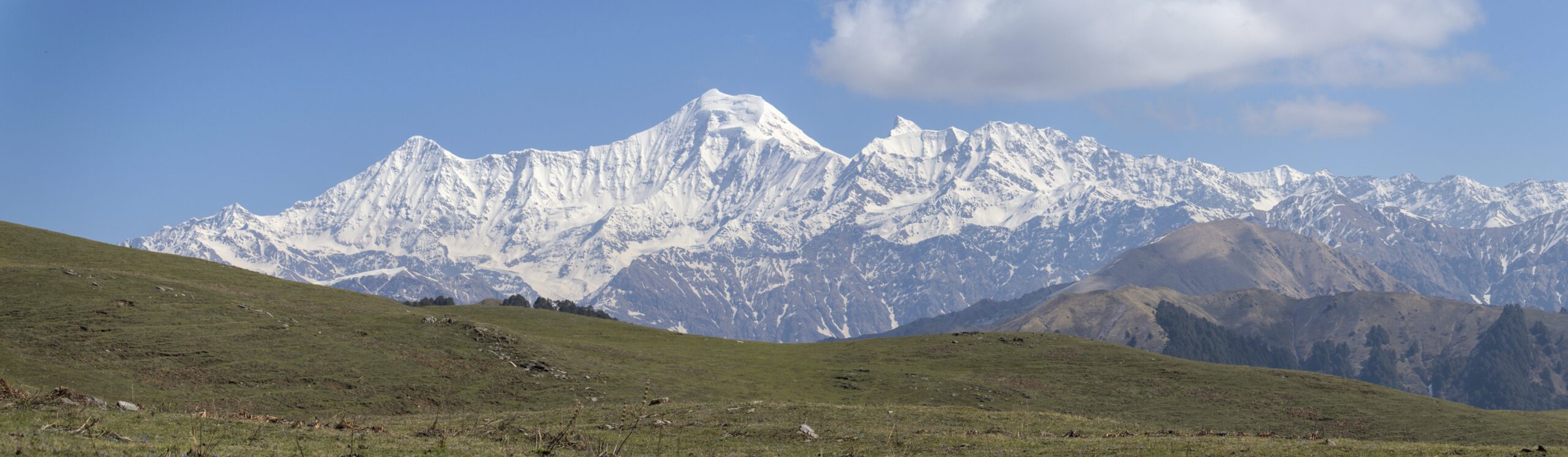
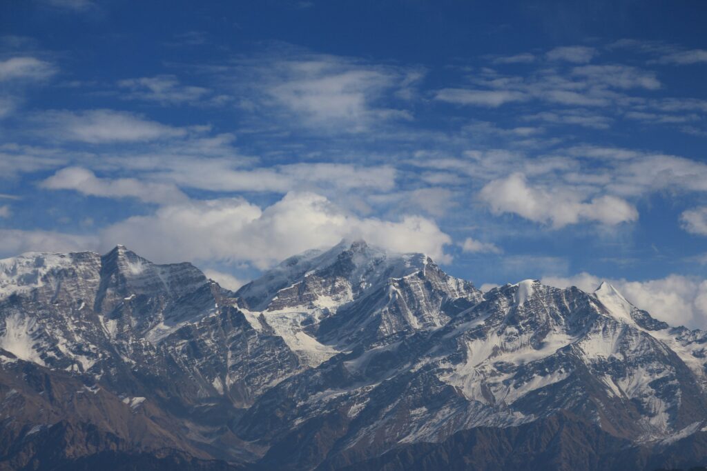
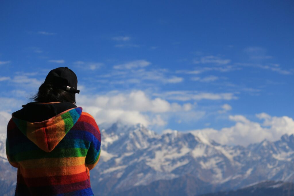
from the high point of the trek, Dayara Top, you get very wide views of the Himalayan peaks, including the bandarpoonch and the black peak. watching sunrise or sunset over these mountains is a breathtaking experience you won’t forget.
dayara bugyal trek best time
- summer {May to June}:- the meadows are lush and green, with wildflowers in full bloom. the weather is pleasant, making it a great time for trekking.
- monsoon {september to november}:- this is the best time to visit.offering stunning views of mountains. the meadows are still green and fresh after the monsoon
- winter {december to February}:- the meadows turn into a snow wonderland. if you are snow trekking, this is the time to go.
dayara bugyal temperature
Summer (April to June):
- temperature range: 10°C to 20°C (50°F to 68°F)
- Description: Summer is pleasant, making it an ideal time for trekking and exploring the green meadows. the days are warm and the nights are cool, perfect for camping.
Monsoon (July to September):
- temperature Range : 10°C to 15°C (50°F to 59°F)
- Description: monsoons bring moderate to heavy rainfall, making the region lush and green. However, trekking can be challenging due to slippery paths and unpredictable weather.
Autumn (October to November):
- Temperature Range: 5°C to 15°C (41°F to 59°F)
- Description: Autumn offers clear weather. The temperature starts to drop, especially in the evenings and nights, but it’s still a great time for trekking with beautiful, clear views of the surrounding peaks.
Winter (December to March):
- Temperature Range: -5°C to 10°C (23°F to 50°F)
- Description: Winters are cold and often see heavy snowfall. The meadows are covered in a blanket of snow, transforming Dayara Bugyal into a winter wonderland. It’s a perfect time for snow trekking and experiencing the beauty of the region, but be prepared for cold conditions.
dayara bugyal trek difficulty level
- Altitude: The trek reaches an altitude of approximately 3,408 meters (11,181 feet) at its highest point. While this is not extremely high, it can still challenging due to thinner air and the potential for altitude sickness.
- Terrain: The trek involves a mix of gradual and steep ascents and descents. The trail passes through dense forests, open meadows, and some rocky paths, requiring a good level of fitness and stamina.
- Duration: Typically, the trek spans about 4-5 days, covering a total distance of approximately 20-25 kilometers (12-15 miles). Each day involves several hours of trekking, which can be physically demanding.
- Weather Conditions: Depending on the season, trekkers may encounter varying weather conditions, from clear skies and pleasant temperatures to rain and cold. Winter treks can be more challenging due to snow.
- Preparation: Prior trekking experience is beneficial but not mandatory. A basic level of fitness, proper acclimatization, and appropriate gear can help manage the trek comfortably.
- Overall, the Dayara Bugyal trek is suitable for beginners with some prior trekking experience and for moderately experienced trekkers.
Dayara Bugyal map
Hello! I’m,Ratndip a dedicated trekking enthusiast with a deep love for exploring the world’s most captivating trails. With over 2 years of trekking experience, I’ve had the privilege of hiking through stunning landscapes, from the majestic Himalayas to the lush Amazon rainforest. My journey into trekking started as a personal quest for adventure and has evolved into a lifelong passion for discovering new terrains and connecting with nature.