How Long is the Continental Divide Trail?
The Continental Divide Trail (CDT) is one of the most challenging long-distance trails in the United States, stretching across five states and covering some of the most remote and rugged terrains in the country. The trail's length, however, isn't as straightforward as one might think. Different sources report varying numbers, leading many hikers to wonder: How long is the Continental Divide Trail?
Varying Reports on the Trail’s Length
There are different length estimates for the Continental Divide Trail, ranging from 3,028 miles (4,873 km) This discrepancy arises from factors like alternate routes, trail reroutes, and ongoing trail maintenance. The trail is constantly evolving, with new sections added or rerouted to improve the hiker's experience or preserve the environment.
Official Measurement
According to the Continental Divide Trail Coalition (CDTC), the official length of the CDT is 3,028 miles. This measurement is based on the most up-to-date route, but keep in mind that your actual mileage may vary depending on the specific route choices you make.
The Path of the Continental Divide Trail
Start and End Points
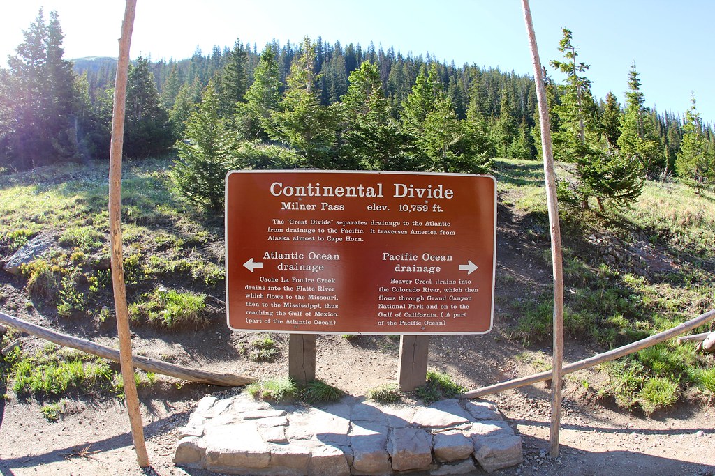
The CDT begins at the Mexican border in New Mexico and ends at the Canadian border in Montana. These two points mark the start and finish of one of the longest and most remote hiking trails in the world.
States the CDT Passes Through
The trail winds through five states: New Mexico, Colorado, Wyoming, Idaho, and Montana. Each state offers its own unique challenges and breathtaking scenery, from the deserts of New Mexico to the towering peaks of Montana.
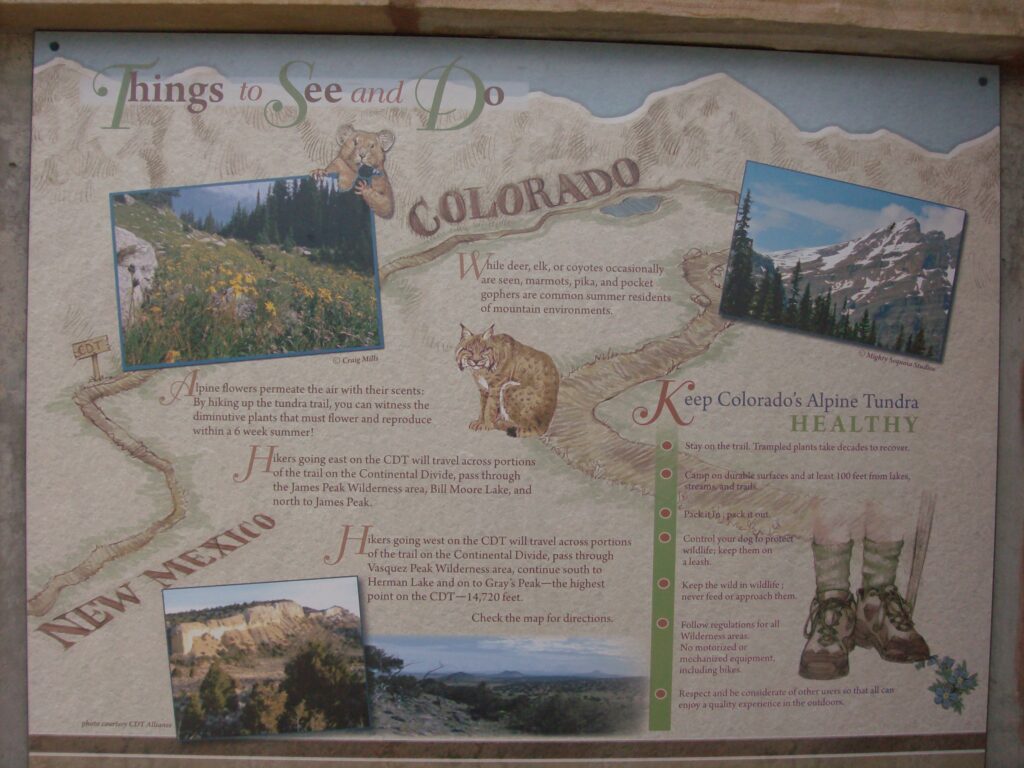
Notable Highlights Along the Trail
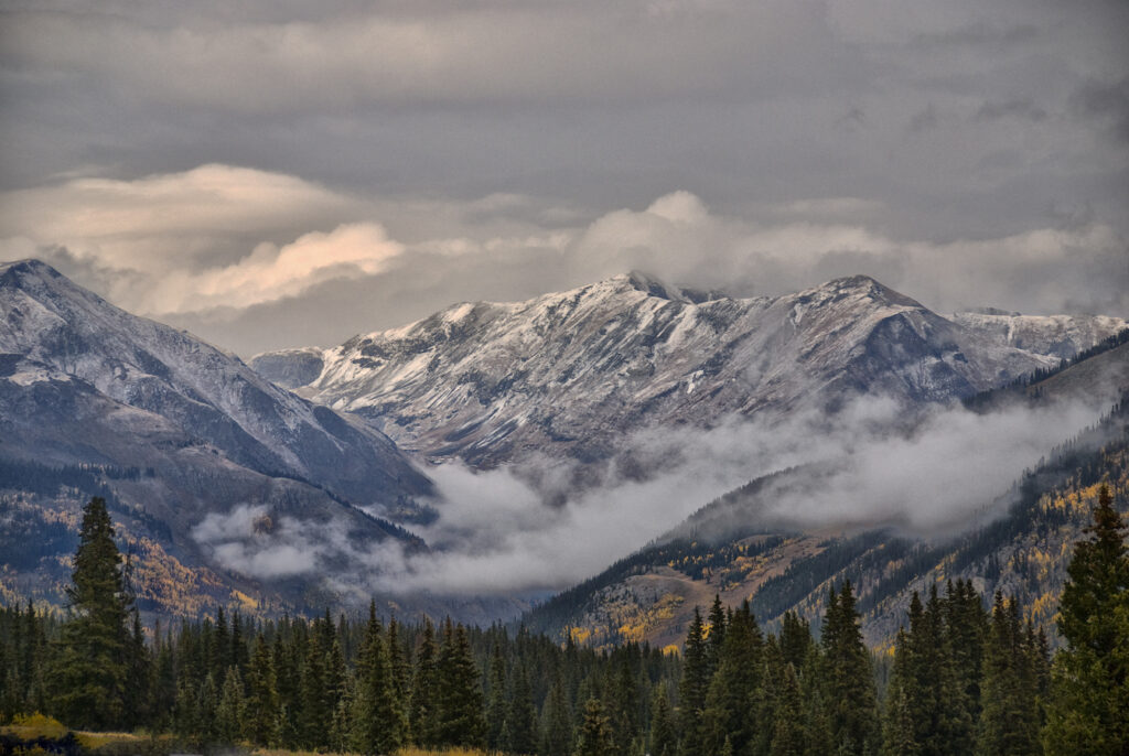
Throughout its length, the CDT offers some incredible highlights, including Glacier National Park, the Wind River Range, and the San Juan Mountains. These locations are known for their stunning beauty and are often considered the crown jewels of the trail.
How Long Does It Take to Hike the Continental Divide Trail?
Average Duration for Thru-Hiking
The typical time frame for completing a thru-hike of the CDT is 5-6 months. This duration can vary widely depending on a hiker's pace, the conditions they encounter, and the amount of time they take for rest days or side trips.
Factors Influencing Duration
Several factors can influence how long it takes to hike the CDT:
- Weather conditions can significantly impact your progress.
- Your pace and fitness level will determine how many miles you can cover each day.
- Trail conditions and resupply logistics can also play a role in your overall time on the trail.
Seasonality Considerations
The best time of year to start the CDT depends on the weather. Most northbound hikers begin in late April to early May, while southbound hikers start in late June to early July. Starting too early or late can result in dangerous snow conditions or extreme heat.
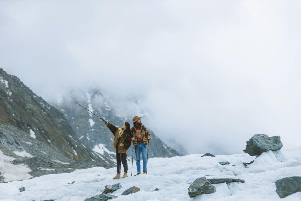
Physical and Mental Challenges on the CDT
Solitude
One of the most significant challenges of the CDT is the solitude. Unlike the Appalachian Trail (AT) or Pacific Crest Trail (PCT), the CDT is much less crowded. While this offers a unique opportunity for solitude and reflection, it can also be mentally taxing.
Big Water Carries & Dry Camping
In certain sections of the CDT, particularly in New Mexico, water sources can be scarce. Hikers must be prepared for big water carries and dry camping, which requires careful planning and strategy.
Snow Travel & Storms
Hiking the CDT often involves snow travel, especially in the high-altitude regions of Colorado and Montana. Storms and big temperature swings can also pose significant challenges, requiring hikers to be well-prepared and adaptable.
High Altitude
The CDT takes hikers to some of the highest points in the continental United States, including Grays Peak in Colorado. High altitude can cause altitude sickness, and acclimatization is essential.
Navigation Challenges
The CDT is notoriously known for its navigation challenges. Unlike the well-marked AT or PCT, the CDT often has poor markings, and hikers must rely on navigation tools like GPS and maps.
Planning Your CDT Hike
Choosing a Direction
When planning your CDT hike, you'll need to decide whether to hike northbound (NOBO) or southbound (SOBO). Each direction has its advantages and challenges, which are worth considering based on your preferences and the time of year you plan to start.
Picking a Start Date
Choosing the right start date is crucial. As mentioned earlier, starting too early or too late can expose you to severe weather conditions. Most hikers choose their start date based on snow conditions in Colorado and Montana.
Permits & Regulations
Hiking the CDT requires several permits depending on the sections you plan to hike. These can include wilderness permits, national park permits, and camping permits. It's essential to research and obtain the necessary permits well in advance.
Continental Divide Trail Permits Checklist
| State/Section | Permit Required | Description | How to Obtain |
|---|---|---|---|
| Montana (Glacier National Park) | Glacier National Park Backcountry Permit | Required for backcountry camping in Glacier National Park. | Reserve through the Glacier National Park website or call the park's backcountry office. |
| Montana (Bob Marshall Wilderness) | Bob Marshall Wilderness Permit | Required for backcountry camping in the Bob Marshall Wilderness. | Obtain at the Forest Service office or online through the Flathead National Forest website. |
| Idaho (Salmon-Challis National Forest) | No permit required for general hiking | Permits are not required for general hiking, but a permit is needed for camping in certain areas. | Check with the local ranger district for specific requirements. |
| Idaho (Frank Church-River of No Return Wilderness) | Wilderness Permit | Required for backcountry camping in the Frank Church Wilderness. | Obtain at the ranger district office or online through the Salmon-Challis National Forest website. |
| Wyoming (Bridger-Teton National Forest) | No permit required for general hiking | Permits are not required for general hiking; a permit may be needed for specific areas. | Check with the local ranger district office for specifics. |
| Wyoming (Wind River Range) | Wilderness Permit | Required for backcountry camping in the Wind River Range. | Obtain from the Bridger-Teton National Forest or the Shoshone National Forest office. |
| Colorado (San Juan National Forest) | No permit required for general hiking | Permits are not required for general hiking, but some areas may require permits for camping. | Check with the local ranger district office for specifics. |
| Colorado (Rocky Mountain National Park) | Rocky Mountain National Park Permit | Required for backcountry camping in the park. | Reserve through the Rocky Mountain National Park website. |
| New Mexico (Gila National Forest) | Wilderness Permit | Required for backcountry camping in the Gila Wilderness. | Obtain at the ranger district office or online through the Gila National Forest website. |
| New Mexico (Santa Fe National Forest) | No permit required for general hiking | Permits are not required for general hiking; specific areas may require permits. | Check with the local ranger district office for specifics. |
Budgeting
A thru-hike of the CDT can be expensive. You'll need to budget for gear, food, permits, travel costs, and resupply. Many hikers find that it costs between $4,000 to $10,000 to complete the trail, depending on their spending habits.
Physical Preparation
Proper physical preparation is key to a successful thru-hike. Training should focus on building endurance, strength, and cardiovascular fitness. Consider incorporating long hikes, strength training, and possibly altitude training into your routine.
Putting Your Regular Life on Hold
A CDT thru-hike is a significant commitment, and you’ll likely need to put your regular life on hold for several months. This includes planning for time away from work, family, and other responsibilities.
Wildlife Encounters on the CDT
Rattlesnakes & Rodents
In the drier regions of the CDT, you may encounter rattlesnakes and rodents. While rattlesnakes are generally not aggressive, it’s important to know how to handle an encounter safely.
Bears & Moose
The northern sections of the CDT, particularly in Wyoming, Montana, and Colorado, are home to bears and moose. Proper bear safety measures, including carrying bear spray and storing food securely, are essential.
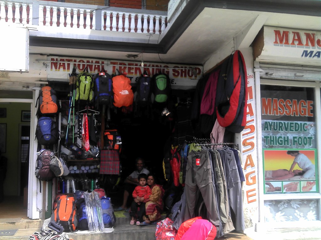
Gear Essentials for the Continental Divide Trail
Backpack & Shelter
Choosing the right backpack and shelter is crucial for a successful CDT hike. Your gear needs to be lightweight yet durable enough to withstand the trail's demanding conditions.
Sleeping Gear
A good sleeping bag or quilt and sleeping pad are essential for staying warm and comfortable during the cold nights on the CDT. Choose gear that is appropriate for the temperatures you’ll encounter.
Camp Kitchen & Water Filtration
Your camp kitchen setup should be efficient and lightweight. You'll also need a reliable water filtration system to ensure you have safe drinking water throughout the hike.
Clothing & Footwear
Layering is key when it comes to clothing for the CDT. Choose lightweight, moisture-wicking layers that can be easily added or removed as temperatures change. Footwear should be sturdy and comfortable, as you'll be covering long distances on rugged terrain.
Navigation Tools
Given the CDT's navigation challenges, you'll need reliable navigation tools such as a GPS device, maps, and possibly a compass. Familiarize yourself with these tools before hitting the trail.
Food & Nutrition
Meal planning is critical on the CDT. You'll need to ensure you have enough calories to sustain your energy levels while keeping your pack weight manageable. Many hikers prefer to resupply along the trail rather than carry all their food from the start.
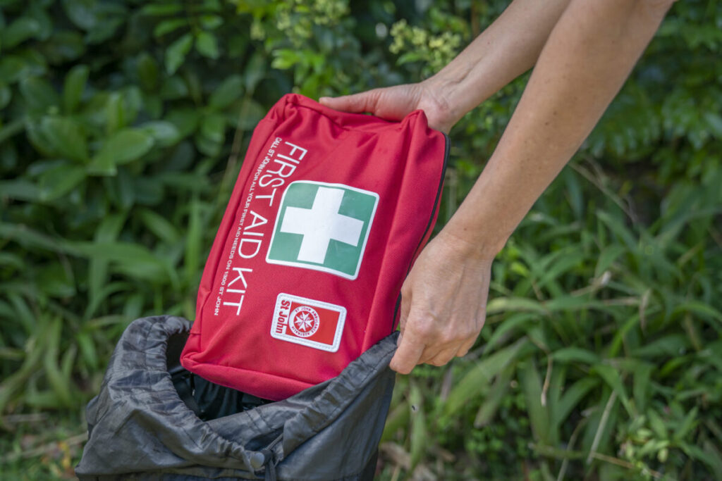
First-Aid & Miscellaneous Items
Carry a well-stocked first-aid kit to handle common injuries and ailments on the trail. Other miscellaneous items might include a multi-tool, headlamp, and extra batteries.
Resupplying on the CDT
Mail Drops
One way to resupply on the CDT is through mail drops. You can send packages of food and supplies to post offices or other resupply points along the trail.
Grocery Stores
In addition to mail drops, there are several grocery stores along the CDT where you can purchase supplies. Planning your resupply points in advance is crucial for a smooth hike.
.
Day and Section Hikes on the CDT
If a full thru-hike isn't in your plans, there are plenty of options for day hikes or section hikes along the CDT. Some of the most popular sections include:
Glacier National Park
This section offers some of the most stunning scenery on the CDT, with rugged mountains, pristine lakes, and abundant wildlife.
Wind River Range
The Wind River Range in Wyoming is another popular section, known for its dramatic landscapes and challenging terrain.
San Juan Mountains
The San Juan Mountains in Colorado provide a mix of high-altitude hiking and beautiful alpine scenery.
How Dangerous is the Continental Divide Trail?
Weather-Related Dangers
The CDT is known for its extreme weather conditions, including snowstorms, lightning, and temperature swings. Hikers must be prepared for sudden changes in weather and know how to handle these situations.
Wildlife Hazards
Encounters with wildlife, particularly bears, can pose a significant risk on the CDT. Proper food storage and carrying bear spray are essential for safety.
Navigational Risks
Given the poor trail markings in some sections, there's a real risk of getting lost. Always carry a reliable navigation tool and be aware of your surroundings.
Physical Strain
The sheer physical demands of the CDT can also be dangerous. It's crucial to listen to your body and take rest days as needed to avoid overexertion.
| Risk | Description | Likelihood | Severity |
|---|---|---|---|
| Solitude | Hiking long stretches alone with limited human contact. | High | Medium |
| Big Water Carries | Carrying large amounts of water due to long distances between sources. | High | High |
| Questionable Water Sources | Potentially unsafe or scarce water sources. | Medium | High |
| Storms & Temperature Swings | Sudden weather changes, including snow and thunderstorms. | High | High |
| Snow Travel | Navigating through snow-covered areas, increasing difficulty. | Medium | High |
| Navigation Challenges | Poorly marked trails and reliance on GPS/maps. | High | Medium |
| High Altitude | Risk of altitude sickness due to high elevations. | Medium | High |
| Wildlife Encounters | Potential encounters with bears, rattlesnakes, and moose. | Medium | High |
| Hitchhiking | Relying on rides for resupply or escape from remote areas. | Low | Medium |
Conclusion
The Continental Divide Trail is a true test of a hiker's abilities, offering unparalleled solitude, beauty, and challenges. Whether you're planning a thru-hike or just dreaming of hitting the trail one day, the CDT provides an adventure like no other.
Hello! I’m,Ratndip a dedicated trekking enthusiast with a deep love for exploring the world’s most captivating trails. With over 2 years of trekking experience, I’ve had the privilege of hiking through stunning landscapes, from the majestic Himalayas to the lush Amazon rainforest. My journey into trekking started as a personal quest for adventure and has evolved into a lifelong passion for discovering new terrains and connecting with nature.